Showing posts with label Transit Oriented Development. Show all posts

Friday, June 9, 2017

Diridon Station and More Notes from French High Speed Rail

There are a couple of pieces of interest that have come out in the last week talking about high speed rail and TOD at Diridon.  Google is getting involved and SPUR is making case studies on main rail station revitalizations the centerpiece of their most recent Urbanist publication.

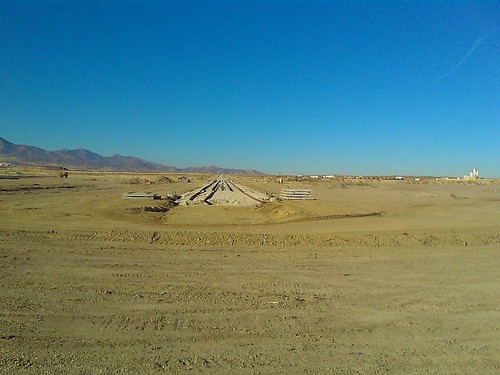
In regards to Google, the thinking for the Diridon area is ambitious and much more intelligent than what Apple has done with their suburban campus.  By buying up properties around Diridon, they are putting themselves at the center of a major regional transportation hub with light rail, Caltain, High Speed Rail, a revamped bus network, and future BART extensions that allow them to perhaps in the future spend less on their own private transportation modes.

"Google ultimately intends to buy all the parcels in a roughly 240-acre area that would be needed for the mega-campus, said a person familiar with the matter."

Our good friend and podcast guest host Eric Eidlin is also now in San Jose working on the Diridon project so I want to go back in time and pull out a few quotes from Episode 2 of our French HSR podcast as we think about transforming the area around Diridon Station.


Pull Quotes from Episode 2

Stephan De Fay on Return on Investment
"For its part, the French state, in designating a project to be a [project of national importance], is not saying that it wants to receive a full return on its investment in a narrow financial sense. Rather, it is affirming that it wants its money to produce real effects – real effects on the economy, on the housing market—and that these effects are not likely to materialize simply by allowing development to occur in a laissez-faire, Malthusian way."
Stephan De Fay on Overcoming Political Boundaries
"The issue that surfaced early on with the Grand Paris project was the strong and enduring divide between the governance structures of the City of Paris and that of the surrounding metropolitan region.  Just one figure that is quite awful.  In the Paris urban region, we have 1,483 mayors.  This is awful in terms of governance.  The first step of the Grand Paris was to deal with this.  We realized that it was a matter of economic competitiveness.  In order Paris to be economically competitive with other global cities—and with London in particular—we realized early one that we needed to overcome this governance problem."
Stephan De Fay on Big Development and Transportation Project Timelines
"And one point that bubbled to the top that focused a lot of attention because it’s a very big investment --32 billion Euros in this case—was the transportation project.  But the transportation project was actually not really the primary driver.  It was a consequence of a vision, where of course, mobility was a crucial element.  After articulating the vision, the next step was to figure out how to implement it.  And here we came back to transportation.  Because the problem between transportation and district redevelopment is that the transportation project takes longer than the first steps of the urban redevelopment of the district.  And in fact, you can’t really start the redevelopment of the district in earnest until the transportation infrastructure that will serve it is about to be operational.  It is not enough for this infrastructure to simply be promised.  And this is the reason why the primary focus of the Grand Paris project today is on the transit stations and supporting infrastructure.  Because the stations are the nodes of the urban development of the different districts that surround them."
Stephan De Fay on Governance
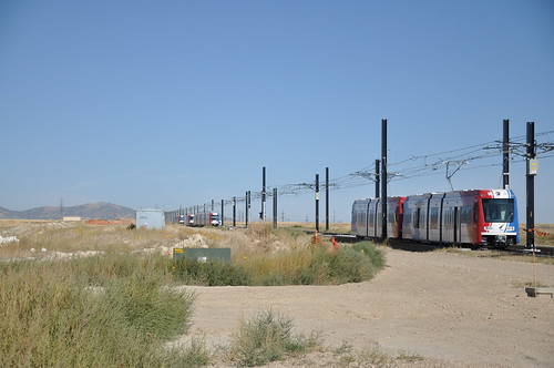
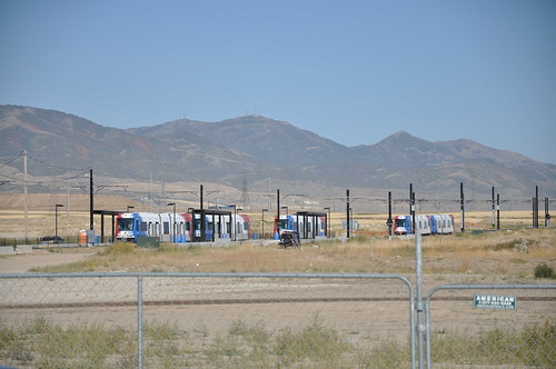
"One of the clear challenges that I noticed in California – and this hadn’t occurred to me before coming to California in October – relates to governance.  In France, we have one French railroad company and not 15. When you enter a transit station in the Bay Area, it is very strange.  In San Francisco, for example, when you enter a station it is so strange from a European perspective, that there is a lack of comprehensive passenger information.  And there is no integrated ticketing.  And so on.  But this is a big challenge for the customer.   And it is something that needs to be dealt with both at the station level and the district level."
Etienne Tricaud on Risk and Integration
"I would also like to mention a risk.  Coming from our experience, there is one risk in a project like Diridon or LA Union station.  And it is that some decisions are taken too early in terms of infrastructure, in terms of the types of projects and location of projects around the station that become obstacles for the next steps.  I remember when we were at Diridon, we had discussions, and I understood that some decisions – or perhaps not decisions, but studies – had been made regarding the location of the future BART portal, as well as for a potential viaduct for the high-speed train.  And it is good that studies had been done and reflections made on all of these questions.  But decisions on these things should only be made if – and only if – they are considered at a more global scale.  And to be sure that the decision is really the right answer for a specific item or issue within the global vision"

Friday, May 5, 2017

Talking Headways Podcast: The Urban Policy Translator

This week we’re joined by Shelley Poticha, director of NRDC’s Urban Solutions Program, who tells us about the organization’s new programs like SPARCC and the City Energy Project. We get into federal policy like the Clean Power Plan and the story of how FTA and HUD were finally connected, and we talk about The Next American Metropolis, the 1993 book about transit-oriented development she wrote with Peter Calthorpe.

Friday, October 28, 2016

Podcast: Meea Kang on Developing Affordable Housing in California

This week I’m joined by Meea Kang, Rail~volution board member and founding partner of Domus Development. I caught up with Meea at the Rail~volution conference to talk about what it’s like to be an affordable housing developer building sustainable projects. We discuss the 16 variances needed to do transit-oriented development in Sacramento, workforce housing in Tahoe on a bus line with 60-minute headways, and what it takes to pass a state law that reduces parking requirements near transit.

Thursday, November 12, 2015

Most Read from November 11th

Here are Yesterday's Top Stories from The Direct Transfer Daily

Photo-Illustration by Darrow; © Richard Cavalleri/Shutterstock

- TRB Research: Linking Transit Agencies and Land Use Decision-Making Guidebook

- Boating is cool in Venice, Not so cool in Miami Beach.

- Turns out self driving cars are a plot for robot imprisonment.  So says Scott Adams

Friday, October 23, 2015

Weekend Reads from The Direct Transfer

Some recommended reads for the weekend or those with a reading budget. ;)

Politico Magazine dives into the topic of TOD and Evanston Illinois. It's long form so make sure to leave some reading time.

Governor Hogan has proposed a frequent bus network in Baltimore to replace the Red Line, but not everyone is happy, especially the mayor which you can see in the Quote of the Day.

And finally, if you were wondering what all the fuss is about for the Paris climate talks, Good Magazine has a short primer.  I'm sure we'll be hearing more about COP21 as it gets closer.

Thursday, September 10, 2015

Podcast: The Urban Displacement Project

Miriam Zuk of UC Berkeley joins me this week to talk about the Urban Displacement Project.  They take a look at gentrification and displacement in the Bay Area.  Definitely have a listen.

Tuesday, May 26, 2015

Podcast: Yonah Freemark on TOD

This week we have Yonah Freemark on the podcast to talk about TOD in Chicago.  How come the population is shrinking even in strong market parts of the city and what can we do about it?  Yonah also mentions why the zoning code is the way that it is and his definition of TOD.  Listen in to hear more.


Wednesday, October 19, 2011

Go Underground Young Man!

Each time I go to a Rail~Volution conference I feel a bit revitalized.  For some reason just seeing people doing all the great work that they do really gets me excited about the future, even though it's always hard when recent politics dictates one step forward and two steps back.  I personally want to take 5 steps forward but we know that isn't how it works. 

Some of the best parts of the conference come from the stats and stories that people tell in the sessions and in the hallways.  Today I learned what "Festival Parking" in development projects was from Art Lomenick and yesterday learned about a CDC program that invests in communities looking to improve health outcomes. 

But one of my favorite comments came from one of my favorite public officials.  Harriet Tregoning mentioned in her session (and it was repeated in Streetsblog and STB posts) that subway tracking heavy rail is the best way to go when it comes to surface development.  While there are a few examples of it working around the country, I think the clean slate it affords developers and pedestrians is a huge bonus over the long term.

“In the short term, under-grounding can be very expensive, but in the long term it saves a lot of money,” Zimmerman said. The development that occurs above the station easily pays for the tunnel, and there’s significant savings on maintenance when rails are protected from the elements. But perhaps more important, there’s little difference between a transit line and an Interstate when it comes to fracturing the fabric of the urban environment. “A railroad takes up a lot of space and creates a barrier — something you can’t get across, like a highway,” he said.

This also brings up another thing I would like to see in regions around the country.  Usually we get into the chicken and egg question whether the transit or density needs to come first but ultimately I think transportation investment drives development investment and putting these lines underground allows us to think about these as a long term investment, even though people these days don't think that way.


What I would like to see is a program for building at least three line subway lines in each major city in the United States.  Now I'm not talking about these hybrid systems we get in the United States like BART but true central city Metros with transfer centers at the end that might stretch 3 miles from the center.  What this would do is push cities to make urban development legal.  The demand for development along major corridors stretches from the market generated around the gravity of central employment district.  The benefit is that if you can get further from the center in ten minutes by putting the line underground, you will be able to build higher and create more walkable, sustainable development than you would have with just the bus.  We see what a ten minute trip from downtown on a streetcar can do, we just need to get multiple modes going and augment with the subway. 

I know its dreaming because it can't really happen given the current environment, but its really what I believe should happen.  This model is there with the DC Metro, we just need to make it happen somehow.

Saturday, April 23, 2011

Transit to Empty Fields

In the United States we haven't been able to talk a lot about transit creating new neighborhoods whole cloth since the early 20th century. Now places like Portland have been able to take abandoned rail yards and turn them into new neighborhoods with a walkable street grid and amenities.

In Europe now, it's being taken even further. Eco suburbs in places like Freiburg are popping up and development is happening as tram lines are planned. The map below from a paper written by Berkeley student Andrea Broaddus shows the expansion of the network.

As an interesting side note, Broaddus' study noted that two ecosuburbs were the same except for parking provisions:
Travel behavior data showed that residents of Rieselfeld had higher rates of transit use in an otherwise typical modal split, while Vauban’s residents had extremely low car share and high bicycle share. These differences were attributed in part to more Vauban’s more restrictive parking policies.
But back to the Reiselfeld. Of interest here is how the development was conceived. The tramway was built before the development and historical Google Earth images show this development happening.

Reiselfeld in 2000


Similar image from a different angle, from The Modern Tram in Europe.

And a more recent image in 2006


To me this is awesome. This is true transit oriented and development oriented transit. Could we ever do something similar here in the United States? It's already happening. Though perhaps not as eco-friendly or dense as would be most sustainable.


Salt Lake City is building the Mid Jordan Trax line into the Daybreak Neighborhood drawn up by Calthorpe. While all the houses are planned to be a five minute walk from local shopping and destinations, there are still a lot of single family homes. Additionally, there is a freeway that is being constructed up the left edge of the valley that will just make Utah's air pollution and inversion days that much worse in the future.

Image courtesy of Calthorpe Associates:


Salt Lake City Suffers from Wicked Inversion Days

Ogden Trip

Flickr Photo via UTA

Mid-Jordan TRAX Segment Map

Daybreak Under Construction - Flickr Photo via Jason S

Daybreak Trax Station

Daybreak Completed - Flickr Photo via Brett Neilson

New Tracks for Trax

All the negatives aside, I think its an interesting experiment and one worth watching. And watch from the air we will...

2003


2005

2006

2009


More Flickr photos at Daybreak from UTA

S70s In The Distance

New Vehicle Testing at Daybreak

And finally a little easter egg for LRT Vehicle nuts.

Tuesday, January 25, 2011

Unconventional Thinking On Charlotte

A lot of times I'll see an article or a piece that I want to comment on but hold off to see if more of a complete picture comes through. I'm glad I did this time because I've waffled back and forth on the idea of Light Rail on Charlotte's Independence Boulevard. When the debate raged between BRT and LRT on this corridor back in 2005-2006 I felt like BRT would have given the corridor a raw deal. Partly because frequencies and vehicle capacity would mean much more in operating costs even if the capital costs were lower.

At that point there was a lot of support from local mayors (like former Matthews Mayor Lee Myers) and communities for the light rail line but as usual no money. So the decision to pick a locally preferred alternative was shelved for a later date several years down the road when there might be money available.

However recently Mary Newsom at the Charlotte Observer tweeted then blogged about a ULI session that suggested that Independence should be HOV lanes and a Streetcar should be run up Monroe Road. Yonah has a good graphic for this over on the Transport Politic. Initially when I saw the tweet I thought that was a really dumb idea. I had seen the fight between LRT and BRT before and the current suggestions were for the line to be a rapid bus line in the HOV lane and a streetcar on Monroe Road.

While still rapid transit, all that type of transit would do is reward people living further and further away from the city without changing any of the land use patterns closer to the city center. The streetcar might do it but I'm starting to wonder whether line haul streetcars are a great idea for places that would rather have more rapid transit options. Just as Yonah points out, you aren't really going to be getting anywhere fast.

But then I started to warm up to the idea of HOV lanes considering that freeway alignments don't really work well for TOD considering most of the really good property is taken up by the size of the road. Especially if the road is going to be the size of a freeway at some point ceasing to be an actual boulevard. But that is the rub.

The problem here is the same problem that's happening when TTI releases its urban mobility report based on a travel time index. All the engineers at the state DOT care about at this moment are making the trip from a place outside of the Loop into downtown faster. They want to widen this road and make it a full fledged freeway. But that decision alone goes against the centers and corridors plan that Charlotte developed after they voted for the half cent sales tax initially and revamped in 2010.


The TTI travel time index is the wrong measure, especially if it is going to push infrastructure investment that drives the vicious cycle of speed to further away parts of the region. We know now rather that access is a more important measure. CEO's for Cities laid it out in their Driven Apart study, showing that travel time skews the data towards travel flow rather than closer access to work or other destinations.

What this means for Independence Boulevard is that if the NCDOT gets a hold of it and upgrades the outer sections to a grade separated highway, then the ability to change those patterns for better access to an employment node is lost forever. One of the commenters on Yonah's post noted that the outermost piece of Independence is actually a boulevard instead of a highway. Not a boulevard in the sense of a grand boulevard but it is still not a grade separated highway.

The one problem with changing it to a grand boulevard is that urban development patterns that people like are harder to realize further from the downtown or major employment cores. Because of land values and other market forces, the further you get out from major gravity centers like downtown Charlotte or the University, the harder it gets to realize new urban style development. In fact, the South Corridor already shows that development further out is harder to realize. The map below shows development projects from 2007 and before on the South Corridor. The basic distance from downtown before development starts to wane is approximately 3.5 miles. Basically, the strong market of downtown seems to be extended with access provided by the transit line. This is about a 13-15 minute trip to downtown.

Source: Realizing the Potential One Year Later

Part of the reason for this is the travel time people are willing to endure to get downtown. It's not likely that people will take the streetcar from the outer edges of Monroe Road or Central Avenue unless they have no other options. Additionally, this is why an Independence Light Rail line gets a bit tricky. But we need to start thinking of Independence not as a corridor feeding downtown but rather as a future mass that will have its own gravity. And I believe that gravity can be achieved with a strategic investment in the road to make it an urbanism changing Boulevard.

Considering the section of Independence that is already most like a freeway is within the 3.5 mile radius, its hard to imagine much happening in the short term along the Boulevard. Below shows the ~3.5 mile radius. The yellow shows the part most like a freeway already. The red shows the Boulevard and the light blue is the railroad corridor that is parallel to Independence. The Orange is the Central Streetcar.


This means that a Monroe Streetcar would be good for the inner 3.5 miles but two different service types will be needed further out for shorter and longer types of trips. This also leaves an opportunity for a Grand Boulevard that can attract business and development over time if the road is done right and parcels are slowly transformed into gridded and walkable areas. The approximately 120 feet of right of way are more than enough to build a road that would be friendly to transit, bikes, pedestrians as well as autos.


This corridor specifically could pull offices out to 7.5 miles, creating a new employment corridor which could bring land values up and with it densities over time. Creating a new center should be the goal, not making it another pass through on the way to downtown with HOV lanes for buses that are going to get 5000 riders a day at best. Additionally, by creating two centers with a rapid transit line and streetcar between, the market between the two centers gets stronger, allowing it to support the types of urban development people always draw on their maps at public meetings.

Photo via Hugeasscity

I realize this might be a bit too forward thinking for some people but ultimately we have to change our mindset about what is possible in urban places if we are to give people opportunities to choose different housing and mobility types. Yes this corridor is going to be auto dominated for the near future but that doesn't mean we have to doom it to freewaydom and forever feed sprawling development patterns further and further out. In fact, it's possible to create a new center that attracts new transit trips from within its own gravitational field.

Sunday, April 11, 2010

Stadium Implosions and TOD

Well today was the day. 39 year old Texas Stadium was imploded as its functioning life was deemed over. However the death of a stadium opens up new opportunities for urbanism and some challenges.


The Loop 12 station is going to be located here when the development is finally ready for it but I question the planning of a station along a freeway or in a place where the freeway can severely hamper residential development. Part of the problem with getting cozy with the highway is that you cut off half of the walk shed from the station. In this instance, it's even more than half with the number of freeways that exist in criss cross. Below is the map of the regional transit plan and below that is the station location sourced from the environmental impact statement.


You can see Texas stadium where the main redevelopment opportunity is on city owned land. But the planned station is on the other side of a major freeway, and most of it is a private shipping company under the white blob I've drawn to show the area without a freeway barrier near the station. It's likely that this area will be best for office and some dense residential, but a grid network needs to be reintroduced on both sides for it to become a walkable urban place. It might be even better to route the transit through the center of the white blob to maximize the station area. It does move the station further away from the stadium parcel, but at the same time, it increases the probability of transit accessibility for buildings within the vicinity of the station.

It's a hard decision, but ultimately we need to stop building stations and alignments that are based on the previous freeway paradigm. Creating walkable urban places that connect to others through transit means that we need to connect opportunities, not freeway medians.

Monday, March 22, 2010

Double Vision

While it's great that the Chronicle and others are calling on Houston Metro to have a regional vision with goals, it means nothing without a tandem city land use and development infrastructure strategy. While Houston has no zoning in the usual sense, it does have everything else needed to regulate development (restrictive covenants, parking requirements, setbacks etc). The region can't just keep building HOV lanes and even light rail/commuter rail lines to chase development. Chasers never prosper, but leaders do.

Friday, January 22, 2010

TOD Will Pay Someday

Unfortunately it feels like there is a bit too much optimism that TOD will pay for infrastructure such as rail. Really though, the increase in value brought by new transit lines has too many people fighting over it, from the basic infrastructure to affordable housing to the lines themselves. We can't expect to put all of that weight on the back of a few projects. However we keep making TOD out to be the savior of all. I feel like it can do a lot of things, just not everything.

Wednesday, January 6, 2010

Is It a Wonder How Housing Prices Are So High?

I appreciate environmental regulations and the like, but it seems like a lot of folks in California just take it too far:
Talk of any development along the rail line has raised concern in the environmental community, some of whom believe the system will act as a catalyst for growth, as developers try to build for those who want to live near a train station.
and this:
Under proposed air-quality guidelines, for the first time in the U.S., if extra cancer risk meets a specific threshold, the developer would be told to study the potential health effects of the freeway pollution on the people who would live in the homes. That would be in addition to what the developer is already required to do: study the effects of the housing on freeway traffic and the surrounding environment. If the health risk is too great, the developer might need to modify or scrap his development plan, or spend extra time persuading the city or county to approve it.
If we can't develop near transit stations or near freeways in existing urban areas, where the heck are people supposed to develop new homes that won't affect the environment? Am I missing something here?

Tuesday, January 5, 2010

Can One Development Catalyze a District?

And is it right to be developing once vital industrial land? It's a question that often comes up that I don't quite know the answer to. Here in Oakland many properties in West Oakland have been deemed off limits to commercial or residential development. Many council members want to preserve the industries that provide much needed jobs and an economic boost.

In Denver, there are developers who are looking to revitalize the South Broadway area around the Evans station that is primarily industrial. Much of the project is a mixed use redevelopment on six acres that was once a superfund site. The developer is a single developer which also begs the question of how a market gets started. Once he proves that the area is changed and continues to build more and more projects, other folks will follow suit. But ultimately the developer is the one who will boom or go bust.

I find this interesting because everyone is always looking for the next big neighborhood or district. In the past improvements have been predicated on good bones. The gridded street network already exists and a light rail station is already near by. But at the moment the market isn't there. Could it be a single developer who creates a market? Or are markets organic and ultimately unpredictable. I guess we'll find out.

Sunday, November 15, 2009

Transfer Rights

I don't quite understand why transfers of development rights aren't used more in cities looking to densify areas around transit and preserve open space. It seems like a really easy way to show instantly the benefits they are recieving and make real progress instead of just hoping for it.

Tuesday, November 10, 2009

The Market Must be Right

There's an article from London Ontario with the ever awesome Troy Russ of Glatting Jackson discussing what light rail can and can't do. One of the things it can't do is change the market around its stations. While there is a lot of hope out there that just building a light rail line will solve most if not all the worlds problems, hope alone won't make it so.
"The biggest misconception about transit is it's the reason development happens," said Russ, a planner in an American company, Glatting Jackson, who has designed rail lines in Charlotte, Pittsburgh and Orlando and stations in Denver.
Much development we've seen with recent light rail lines has been from the ability to expand the sphere of a market like downtown, but not change it. The line also has the power to shape an existing market. This is what the Portland Streetcar did when it pushed most of the development in downtown for the last decade along its corridor. I also believe that the streetcar allowed the market in Portland to feed on itself creating a synergy that wasn't possible without it or regulations that shaped growth around it.

So I would urge caution when pumping up that local light rail project or streetcar as the answer to a lack of development pressure. Alone without other regulatory help that swings the pendulum away from today's road paradigm, the tracks will lay dormant. But if you can figure out where the market is going to be next and lay down the rules, it's likely that shaping the development will be as easy as aligning poles on a magnet.

Tuesday, September 29, 2009

Tuesday Night Notes

Vancouver puts its hopes along the Canada Line into TOD
~~~
Is City Living the way to a wealthier nation? I'm not sure if it's just city living. I think it's creation of wealth through location efficiency. But currently our rules are set up to not let that happen.
~~~
Charlotte is master planning at the North End rail yards south to Dilworth. Wonder if they are thinking about the Ringstrasse? Could tie it together quite nicely.
~~~

Thursday, August 13, 2009

Shameless Plug

So at work we're starting a blog. The basic premise is best practices and information on Transit Oriented Development including hopefully posts from experts from around the country and more information about the work we do. I don't mention work here much because well I'd rather this blog stay my own opinion and not drag work into it. But in this instance, I thought folks would be interested in what is going on over there. So check it out if you get a chance.

Tuesday, August 11, 2009

Doubling Down - Town

The New York Times has an article about the railyards in Sacramento changing into a new neighborhood. While the market is somewhat down from mid-decade, it seems as if industrial areas adjacent to downtown are still a hot commodity.
When completed, the old Union Pacific property will become an extension of the downtown, effectively doubling its size...

Although it is playing up the history of the site, Thomas Enterprises plans to make new and old buildings harmonize through the use of similar materials, notably brick and glass.“This will not be ‘suburban urban,’ ” said Mr. Rich, alluding to the faux-historical style of many recent outdoor shopping centers. The Railyards, he said, will be “gritty, like a city.”

This will also be the pass through for the DNA line phase 1.